Thursday, July 31, 2008

Sea Oats

Sky Watch Friday


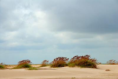
We would like to share a photo that we made last fall on a trip down to the Rio Grande Valley in South Texas. It is a photograph of Sea Oats which grow on the eastern coasts of the U.S, Mexico, and the Islands of the Caribbean. I have been trying to photograph them for years, but I could never find a stand of Sea Oats that really suited me. What I had been looking for was a grouping of the oats leaning in a steady quartering wind to show some dynamic motion and add interest to the scene. I finally found it! An added bonus was the beautiful, mature fall colors set against clean sand and an interesting sky.


Sea Oats (Uniola paniculata)
Nikon D200, 90mm
1/400 sec, f/10, ISO 200


The sky is a typical marine layer which has lifted and can't decide whether to rain or break. It had showered much earlier in the morning. The stiff breeze was drying out the surface of the sand and creating small ripples in the surface (seen in the enlarged photo). Not seen in the photo are the grains of sand skittering across the upper beach above the tide line, reshaping the landscape, and pelting me mercilessly. Oh, the trials a photographer must endure to get the perfect picture....

Can you smell the clean, fresh ocean air? The temperature was a perfect 75-80 degrees. We drove along the beach at the water's edge for about 10 miles in our 4wd Toyota 4Runner. This area, called Boca Chica, is south of South Padre Island, and is separated from it by the channel at Port Isabel. This photograph was taken about one mile from the Rio Grande River, which forms the Texas/Mexico Border.

We had lunch in the 4Runner, facing the Gulf of Mexico, with the front wheels just being caressed by the incoming waves. What a view!

This is the same area and trip where we photographed the Oyster-catcher shown in a previous post. Click here to see this magnificent bird with his haughty stride, strolling on the beach. Martha photographed him as we drove past.

Troy and Martha

Note: Sea oats are well suited to saline environments, and are often used in soil stabilization projects, because their long root structure firmly holds loose soil. Sea oats are a protected grass in most states along the East Coast.


For other SWF posts,
see Tom's new SkyWatch site here.
.
Wednesday, July 30, 2008

Butterflies

.
For your enjoyment - color and pattern.
Some beautiful, some colorful.
Some plain, some rare.
(Click photo to enjoy)


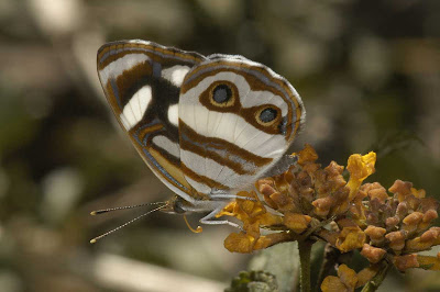
Blue-eyed Sailor


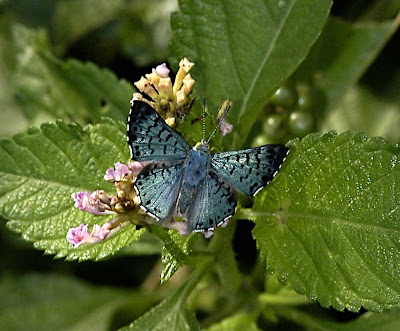
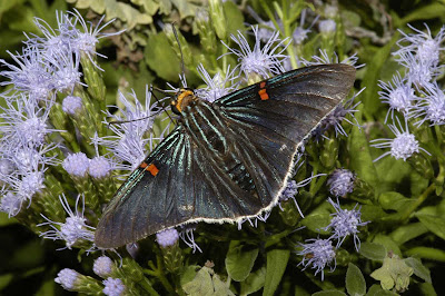
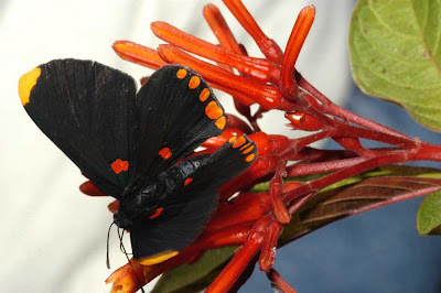
Blue Metalmark


Blue Metalmark (underside)


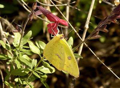
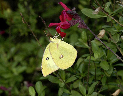
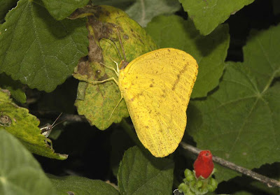
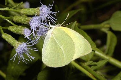
Cloudless Sulphur


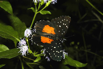
Crimson Patch


Dogface


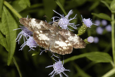
Dorantes Longtail


Guava Skipper


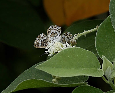
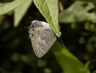
Laceys Scrub-hairstreak


Large Orange


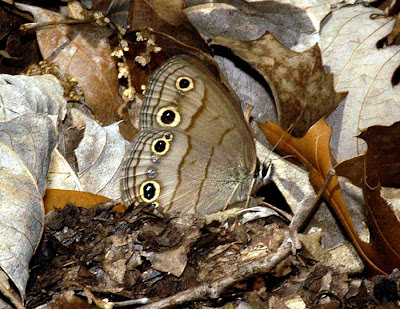
Little Wood Satyr
Violas form

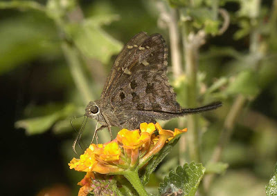
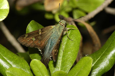
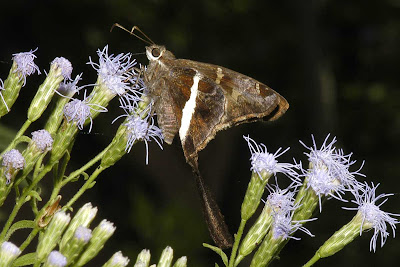
Long-tailed Skipper


Lyside Sulphur


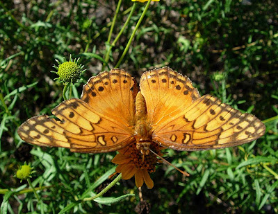
Mexican Fritillary


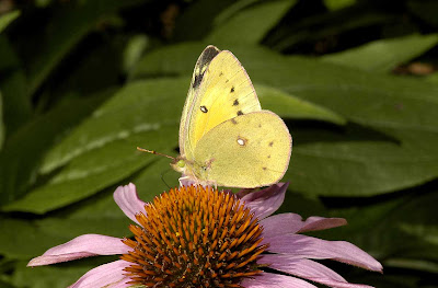
Orange Sulphur


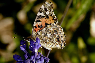
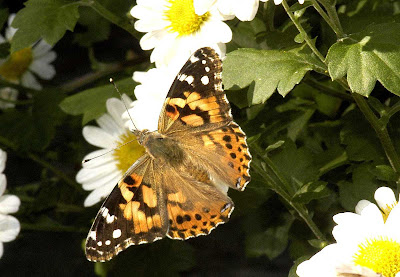
Painted Lady (underside)


Painted Lady


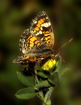
Phaeon Crescent


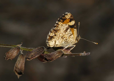
Phaeon Crescent (underside)


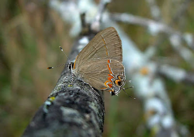
Red-banded Hairstreak


Red-bordered Pixie


Silver-spotted Skipper


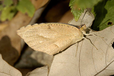
Sleepy Orange
looking like a leaf

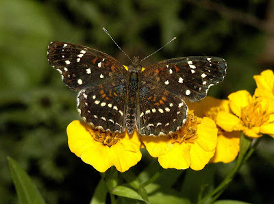
Southwestern Texan Crescent


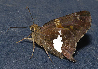
White-patched Skipper


White-striped Longtail


For those that made it to the bottom of this post and are interested in butterfly identification, I recommend Butterflies of North America by Brock and Kaufman. I keep looking at Half-Price Books for a couple of extra copies, but nobody wants to get rid of theirs. My old one is getting really worn.

Comment and let us know your favorite butterfly, color, or pattern.

Photos by Troy and Martha

The letter B today can be seen over at Denise's
.

Monday, July 28, 2008

Art in Nature

Art refers to a diverse range of human activities, creations, and expressions that are appealing or attractive to the senses or have some significance to the mind of an individual. The word "art" may be used to cover all or any of the arts, including music, literature and other forms. It is most often used to refer specifically to the visual arts, including media such as painting, sculpture, and printmaking. However, it can also be applied to forms of art that stimulate the other senses, such as music, an auditory art.

Aesthetics is the branch of philosophy which considers art. If a thing is produced by Nature and stimulates the visual senses, is it considered Art? A painting of a great Sunset is considered Art. Is the Sunset itself Art?

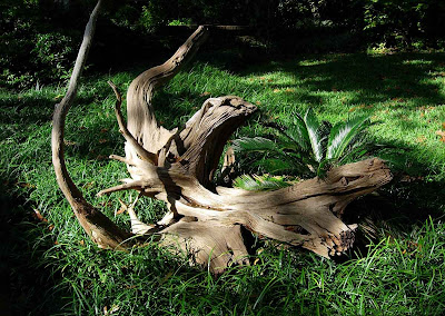
Is any form which stimulates the visual senses to be considered Art? Can the following photograph be considered Art? Or is the object itself the work of Art.


Transformation
© Martha Mullens 2008


Photographed by Martha at the Ft. Worth Botanical Gardens.

Qualities seen here that might stimulate the visual senses are form, texture, and color. An additional factor to consider is the placement in the dappled sunlight.

What do you like about this piece of Nature's art. Or is it just a piece of firewood. What do you see?

Photography by Martha
Post and Critique by Troy

For other interesting photography visit Katney's.

Saturday, July 26, 2008

Muncho Lake and Light

Alaska Sunday XV

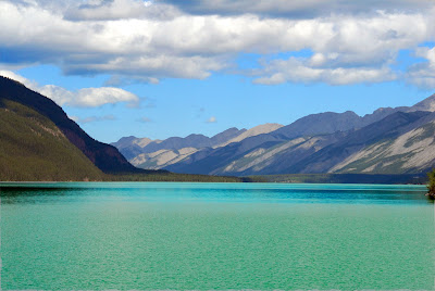
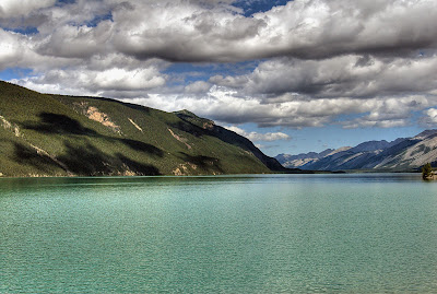
I am going to take time out from the regular Alaska Sunday Travelogue and show two photos that were taken only a couple of minutes apart at different focal lengths and slightly different light conditions. The lighting changed during those few minutes and the matrix metering interpreted the scene differently. I always shoot raw so I was able to make some small adjustments to the photos before saving them in tiff format.. The reason I wanted to show these and bring this to your attention is an interesting post over at Transient Light Photography. Read this at your peril. It will cause you to rethink your approach to scenic (or other) photography. It is not about equipment or software but discusses "light".

Muncho Lake is a highway services community in northern British Columbia, Canada, located at Mile 462 on Highway 97, the Alaska Highway, within Muncho Lake Provincial Park. A person could spend a lifetime in B.C. engaged in hiking, photography, camping, skiing, canoeing, fishing, exploring, prospecting, or just admiring nature (Sorry if I left out your favorite pastime. Leave it in the comments.). Follow the British Columbia link to learn more about this fascinating Province or check out the BC Interior link. Rocky Mountain Girl is from the B.C.Interior. Check out her blog here.

I won't bore you with technical details, but just be aware that the two photos which are vastly different in appearance, are only very slightly different in handling technique and light capture. In the second photo the light was blocked by a darker cloud which caused the exposure to differ slightly. For instance, the small change in light and scene contrast cause the clouds to appear to have darker bases among many other small noticeable details.

Grandpa used to say, "Grain and oats is what makes the Mare go".
Well, light is what makes photography go.

Yes, that is the un-retouched color of the lake with its high copper content.
Depending on light angle of light, it can appear dark blue, turquoise, or green.
(Click on the photographs for better views)


Plan your photo shoot. Even if you are "just taking snapshots", watch the lighting, direction of light, and color balance and experiment if necessary to achieve "that perfect shot". Make every photo a perfect photo.

Troy

Thursday, July 24, 2008

Troubled Waters

SkyWatch Friday


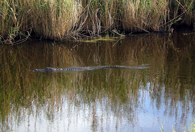
Don't you hate it when you are trying to photograph a reflection of reeds against the sky,
and a big Alligator swims by and disturbs the water.

(Click on the photo to get a better view of troubled waters and a rippled sky)


Rippled Reflection

Anahuac National Wildlife Refuge


The new SkyWatch site is here.
Thank you Tom

For some great Alligator photos visit Klaus at Virtua Gallery.


Troy and Martha

Tuesday, July 22, 2008

Amberwings


A study of the
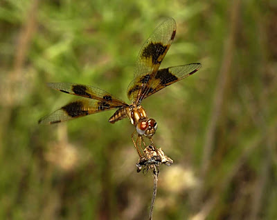
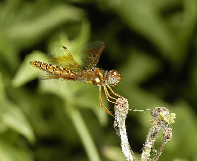
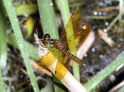
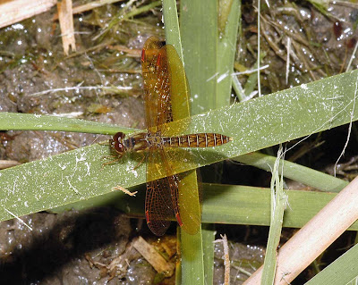
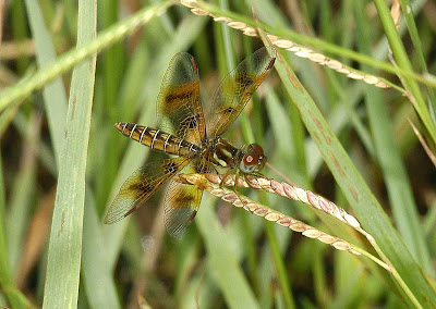
Eastern Amberwing (Perithemis tenera)

A small, stocky, golden dragonfly of the Central, Southern and Eastern U.S.. One of the smallest in North America.

The male usually has entirely amber wings with reddish stigma (the small colored area near the tip of the leading edge of the wing). The full and correct name for the stigma is Pterostigma. The female stigma is usually dark with some reddish coloration. In the female the body has similar coloration and the wings lack much amber coloration. The wings in the female will have variable amounts of dark patches. In Southern populations, both sexes often have more spotting.

They usually perch horizontally on the tips of emergent plants usually along the shoreline. Both sexes are considered wasp mimics. When perched, they often move the wings and abdomen up and down in a wasplike manner.


Click on the photos for better looks at their variability.


Female
Note the excessive dark patches and brown stigma.


Female
Dark patches replaced with small amber patches on the hind wing.
Note the two-toned eye.


Male
Fully amber wings and red stigma


Male
Note the chevron markings on the abdomen.


Female
Beautiful example of average coloration.


The old style ABC wednesday is here.
Thanks Denise.


Troy and Martha
Texas Travelers

Sunday, July 20, 2008

Alaska Sunday XIV

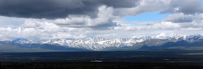
We spent a wonderful day on the Denali Highway (Alaska Route 8), which is a lightly-traveled, mostly gravel highway in Alaska. Over 100 miles of gravel. We saw a lot of birds, animals, and wildflowers. Clean crisp air, magnificent views, and almost no traffic.

One of the views of the mountain ranges to the North.
(Click on the photo for a better view)


Alaska Range


The Denali Highway leads from Paxson on the
Richardson Highway to Cantwell on the Parks Highway. Opened in 1957, it was the first road access to Denali National Park (then known as Mount McKinley National Park). Since 1971, primary park access has been via the Parks Highway, which incorporated a section of the Denali Highway from Cantwell to the present-day park entrance. The Denali Highway is 135 miles (217 km) in length.

The highway is now little used and poorly maintained, and closed to all traffic from October to mid-May each year. Only the easternmost 21.3 miles and westernmost 2.6 miles are paved; whether the remainder should be paved as well is a continual source of debate.

Travelling west, the Denali Highway leaves the Richardson Highway (Alaska Route 4) at Paxson, and climbs steeply up into the foothills of the central Alaska Range. The first 21 miles, to Tangle Lakes, are paved. Along its length, the highway passes through three of the principal river drainages in Interior Alaska: the Copper River drainage, the Tanana/Yukon drainage and the Susitna drainage. Along the way, in good weather, there are stunning views of the peaks and glaciers of the central Alaska Range, including Mount Hayes (13,700 feet), Mount Hess (11,940 feet) and Mount Deborah (12,688). At MP 15, from the pullout on the south side of the road, in clear weather you can see the Wrangell Mountains, the Chugach Mountains and the Alaska Range.

The first 45 miles winds through the Amphitheatre Mountains, cresting at Maclaren Summit, at 4,086 feet the second highest road in Alaska. The road then drops down to the Maclaren River Valley with fine views north to Maclaren Glacier. After crossing the Maclaren River, the road winds through the geologically mysterious Crazy Notch and then along the toe of the Denali Clearwater Mountains to the Susitna River. After crossing the Susitna River the road extends across the glaciers-outwash plains to the Nenana River, and then down the Nenana River to Cantwell on the George Parks Highway (Alaska #3).

The rough gravel surface makes driving slow, but the scenery is truly extradordinary, in some ways nicer than the extension of the Denali Highway into Denali National Park. There are developed campgrounds at Tangles Lakes (MP 22) and Brushkana Creek (MP 104), but there are dozens of pullouts where you can camp on public lands.

Services are scant along this road. Tangle River Inn (MP 20), Maclaren Lodge (MP 42) and Gracious House (MP 82) offer minor repairs and tire repairs and usually have fuel. Both offer rental cabins, as does Denali Highway Cabins (MP 0).

The Denali Highway is an important birding destination. It offers road access to alpine terrain - not that common in Alaska - and, in the brief birding season there, good viewing of a number of alpine breeders, including Long-tailed Jaeger, Whimbrel, Surfbird, Lapland Longspur, Horned Lark, Short-eared Owl, Wandering Tattler, Gyrfalcon and much more. A walk north along BLM's Maclaren Summit Trail (MP 39) can be very productive.

Fishing for grayling and lake trout is decent, if not spectacular, in any of the clear water (i.e., unglaciated) streams.

Because the area is hunted heavily, larger mammals are much less common than in Denali National Park, but moose, grizzly bear, and caribou are fairly common.

Most of the land along the highway is publicly owned. There are several BLM-maintained trails, and dozens of informal trails. This is a stretch of wild Alaska that is pretty much unspoiled, relatively accessible and beautiful.


Troy and Martha

Saturday, July 19, 2008

Giraffe Legs

"A Bit of a Stretch"
(Pun intended)


Giraffe Legs
Photographed by Martha in Rocky Mountain National Park.


The four closest "Legs" on the right reminded me of a Giraffe galloping by.
(Click on the photo for a better view)

Photo by Martha
Post Process by Troy

Camera Critters is here. Come along; you’ll see some unusual stuff.


Thursday, July 17, 2008

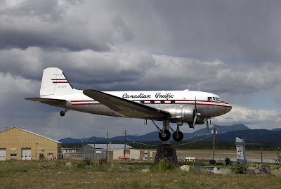
DC-3

Workhorse of the Skies
Sky Watch Friday

I photographed this as we traveled through. It was fun to watch even small breezes and wind shifts turn this large plane. Once a workhorse, now a weather vane. One of my favorite airplanes of all time.


DC-3 at Whitehorse Airport, Yukon Terr., Canada
Worlds Largest Weather vane
(Rain Coming from the West)


The Douglas DC-3 is an American fixed-wing, propeller-driven aircraft whose speed and range revolutionized air transport in the 1930s and 1940s. Because of its lasting impact on the airline industry and World War II, it is generally regarded as one of the most significant transport aircraft ever made. (Follow the link to read about one of the most famous planes in history)


.....To participate in Sky Watch Friday visit Sky Watch Friday.

Troy and Martha

Tuesday, July 15, 2008

Zephyr and Zebra

Zephyr Definition:
A Gentle Breeze or
A West Wind


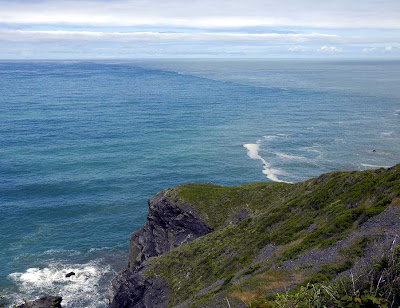
A Gentle Breeze off of the Pacific Ocean from the West

Fulfills both Meanings
Where the Klamath River runs into the Pacific Ocean.


Zebra heliconian
(Notice the lack of yellow - Rare)


To play, visit ABC Wednesday,
mrsnesbitt's place. Click here.


Troy and Martha

Monday, July 14, 2008

Odd Shot Monday

A Good forum to
Showcase your insects


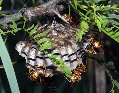
All Facing My Way
(Click on the photo to see what it looked like through the viewfinder)


The photo acquisition goes something like this:

I pinned back a couple of small twigs that were interfering with a nice shot of an active wasp nest. I nicely positioned my camera on my monopod for an interesting shot. I then kneeled down and looked through the viewfinder.

To my surprise, they were all looking my way, except for a few buzzing around. One, and only one, quick photo and I decided that discretion was in order, not valor.


As I slowly backed up and hastily departed, I heard them say.


"After that bright light, when I can see, let's get him."

"Yeah, let's put red knots on his head."

"Let's see how fast this one can run."

"Some of them yell and throw down that black thing before they run."

"I can see now. Where did he go?"

"Oh well, back to tending the larvae. It's too hot to chase him very far today. Anyway, did I tell you about the time that I stampeded the Buffalo in the next pasture over?"


If you liked the story or photo, leave a comment.


These odd posts all started over at Katney's.


Troy and Martha

Saturday, July 12, 2008

Alaska Sunday XIII

Crossing into Alaska

June 20:
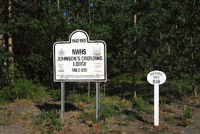
We spent the night at Johnson Crossing in the Yukon, Canada. We were about a week behind schedule (that is if you want to say that we had a schedule). The Johnson Crossing Lodge (historic Milepost 836) is one of the original lodges on the Alaska Highway and this business has been advertising in "The Milepost" every year since the first edition in 1949. The area is known for its wildlife - muskrat, porcupine, moose,eagles, wolves - also bugs and lots of rain.


Original Lodge


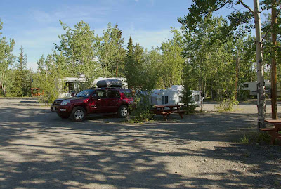
Camping spot
We heard a Boreal Owl,
in the tree next to our camper
during the night.
po-po-po-po-po-po-po


Mile Marker 836


I bought my first Milepost in about 1952. It was then that I decided that I wanted to drive the "Alcan Highway" some day. It only took me 54 years before I realized my dream. It was well worth the wait. Little did I realize back in 1952 that I would be on the road 16 weeks roundtrip. Also little did I realize back then that I would be married and have 3 nice Nikon digital cameras instead of my little Kodak Brownie box camera. I am still going through the 18.000 photos that we kept and burned onto DVD's. I now use 2 "1 Terrabyte" cross-referenced external hard drives for photo storage. It's just about time to buy another.


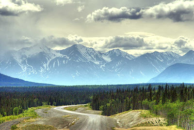
Four things ahead
(Muddy road, Mountains, Border crossing, and Alaska)


Fast forward to
June 22:
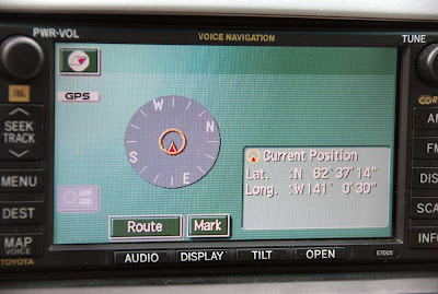
We had been driving hard all day and we were heading for Tok, Alaska and our campsite for the night. We had heard that they had been closing the Border Crossing station at night. We finally crossed at 4:30 PM Alaska time and after another 30 minutes found a nice turnout to rest a little before the last leg of the day. The first Tundra Swan of the day was only a couple of miles after we crossed into Alaska. Whoo-hooo. Also just after crossing into Alaska our Navagation system changed screens. For the 5 weeks we were in Alaska, all it showed was the Latitude/Longitude and direction. That was OK, I had a box full of maps.


Alaska Crossing
(only 4 degrees below Arctic circle)


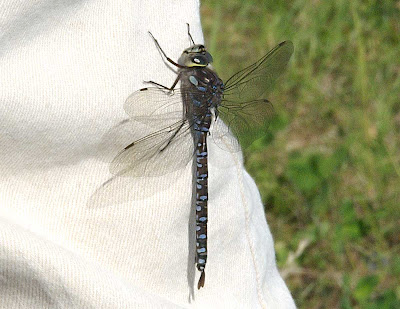
Variable Darner
(A new Dragonfly for our Life List)
(Our first Dragonfly in Alaska)


Tune in next week for further adventures.

Troy and Martha

Wednesday, July 9, 2008

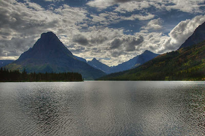
Two Medicine Lake

Glacier National Park
Sky Watch Friday


Sometimes you have to take what Nature gives you.
We only had a couple of hours in the late afternoon to visit here.
Not the best conditions to photograph a lake and mountains.
Such as shooting into the Sun with 70% cloud cover.
It was an interesting sky though.

Two Medicine Lake
(Click on the photo to see the colors in the water)


The gusting wind was causing ripples on the lake,
therefore, there were no nice reflections.
It did cause one interesting phenomena:
Ghostly reflections of the mountains and sky.
Also notice all of the colors in the water.
How many different colors do you see in the water?

To participate in Sky Watch Friday visit Wiggers World.


Troy and Martha